Skip to content
The Map Den
The Map Den

Mapping the latest interests in the GIS, Mapping, geography and anything in between.

Primary Navigation Menu
Menu
  • The Map Den
  • maps
  • data visualisation
  • My Maps
  • Music Map
    • Music Map
    • Music Map: FAQs
    • Music Map: Archive
  • About

Uncategorized (Page 2)

Polder and Wiser – The Netherlands

2017-03-18
By: TheMole19
On: March 18, 2017
In: gis, maps, My Maps, Uncategorized
Tagged: dtm, dutch, engineering, flood, flooding, geography, geospatial, gis, mapping, maps, nederlands, netherlands, OriginalContent, raster, water, zonalstats
With: 0 Comments

I’m a self confessed Dutchophile. There’s something about the colour ‘Oranje’, the unique sound of the language (which I’m ‘trying’ to learn), the windmills, clogs, tulips, hagelslag, stroopwafels, Edam cheese and (until recently challenged) liberal attitudes. I feel there is much to admire about the resourcefulness of the people of the Netherlands, once a economic powerhouse in the 1600s, where making the most of limited land has been vital. This was particularly embodied by the philosophy of ‘Totaal’, where the ability of space to have multiple uses influenced (particularly architectural) philosophies within the general liberal Dutch culture of the 20th Century. Famously, this was reflectedRead More →
06. Map of The Day – The Shape of Slavery

2017-03-16
By: TheMole19
On: March 16, 2017
In: gis, Map of the Day, maps, Uncategorized
Tagged: culture, gis, mapping, maps, Motd, politics, Population, racism, usa, web development
With: 0 Comments

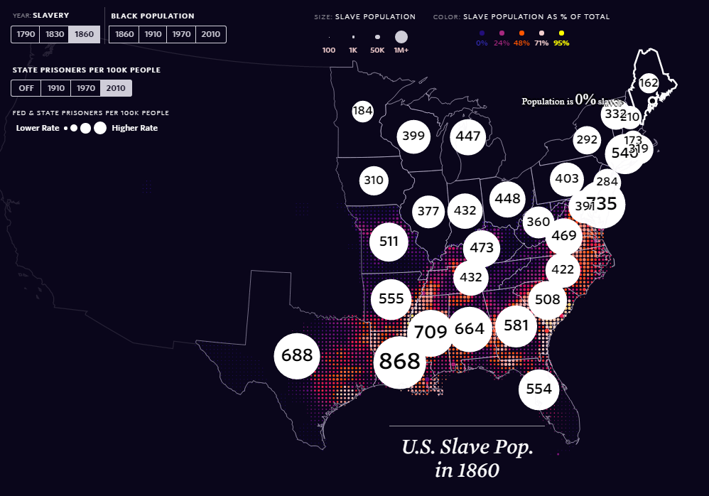
It’s been a while since I’ve added to this feature for various reasons, but thanks to the ‘The Pudding‘, a superb infographics and ‘visual essay’ based site, there is a excellent and important entry for Map of the Day. The Shape of Slavery evidences historical and modern day racism, by providing geographical representations of the areas of United States of America where proportion of African-Americans have been over time, the numbers of slaves up until it was outlawed, and the number of (black) incarcerations per state. This is a well designed and thought out web map, which utlises topojson.js and other Javascript libraries, to tie inRead More →

Happy St David’s Day – Dydd Gŵyl Dewi Hapus! (Map of Wales)

2017-03-01
By: TheMole19
On: March 1, 2017
In: gis, Map of the Day, maps, Uncategorized
Tagged: culture, etymology, history, mapping, maps, Wales
With: 1 Comment

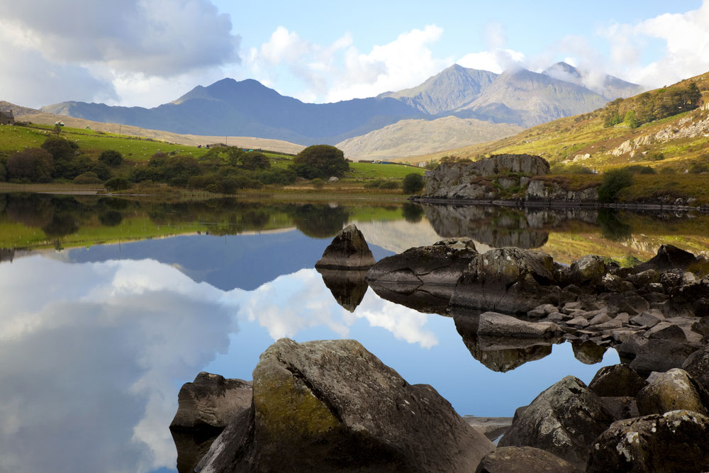
Happy St David’s Day/Dydd Gŵyl Dewi Hapus to all those around the world with Welsh links or sympathies. For those unaware, St David’s Day on 1st March,  is the national day of Wales, celebrating the saint day of the patron saint of Wales, David, and is an excuse (if ever needed) to stock up on Welsh flags, sup some Brains Beer, tuck into Welsh rarebit and Welsh cakes, and sing Calon Lân while watching reruns of Wales beating England in rugby. With all stereotypes out the way, the nation building of Wales/Cymru is an interesting one. The history is uncertain, but Wales has it’s originsRead More →

Urban Population Change 2010-2015

The Urban Age – Global Population Changes

2017-02-22
By: TheMole19
On: February 22, 2017
In: gis, maps, My Maps, Uncategorized
Tagged: arcgis, geography, gis, maps, OriginalContent, politics, Population, world
With: 0 Comments

One of the things I’ve enjoyed so far in creating The Map Den, is being able to share some of the latest and interesting pieces of work and tips coming out of the GIS and mapping industry. The ‘science of where‘ community is alive and strong. However, it’s time I did some original mapping content myself. Today I’m starting simple, but nonetheless importantly, looking at global urban and rural population increases. Created through static maps created in ArcGIS and joining with population data from United Nations between 2010-2015, these maps investigate the continuing phenomenon of global population increase and the urban to rural shift. WeRead More →

Aggregating points: JSON on SQL and loops on infowindows

2017-02-20
By: TheMole19
On: February 20, 2017
In: gis, maps, tips, Uncategorized
Tagged: carto, gis, json, maps, sql, web development
With: 0 Comments

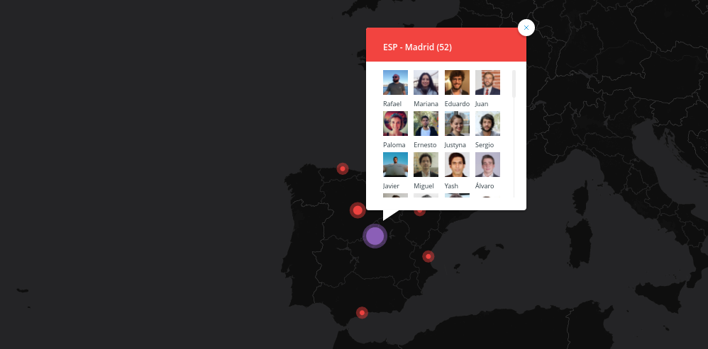
Fantastic bit of code and tutorial about aggregating point data for JSON objects using SQL. geomaticblog NOTE: I’ll use CARTO but you can apply all this to any webmapping technology backed by a modern database. Get all the data So we start with the typical use case where we have a one to many relationship like this: Easy peasy, we have a map with many stacked points. From here you can jump to this excellent post by James Milner about dense point maps. My example is not about having thousands of scattered points that at certain zoom levels overlap. Mine is a small set ofRead More →

Fuzzy Lookup: My Plugin Baby

2017-02-16
By: TheMole19
On: February 16, 2017
In: gis, tips, Uncategorized
Tagged: data, databases, excel, geospatial, gis, joins, plugin, tip, vlookup
With: 0 Comments

So this isn’t strictly a GIS or mapping tool or tip that I thought I’d share, but considering the amount of time and importance of joins, spreadsheets, datasets and databases in the profession, or even outside geospatial work, this little tool called ‘Fuzzy Lookup’ may come in handy. Often when trying to query, search or join up one table to another, or for whatever purpose, VLOOKUP can do just the job, ‘vertically looking up’ one value, in order to display another. If you are new or unfamiliar to VLOOKUP, Debra Dalgleish has an awesome blog, Contextures to help with this and much more even forRead More →

5. Map of the Day: Knock on Wood

2017-02-15
By: TheMole19
On: February 15, 2017
In: Map of the Day, maps, Uncategorized
Tagged: anthropology, canada, cartography, culture, geography, greenland, greenlandic, history, inuit, maps, Motd, old maps
With: 2 Comments

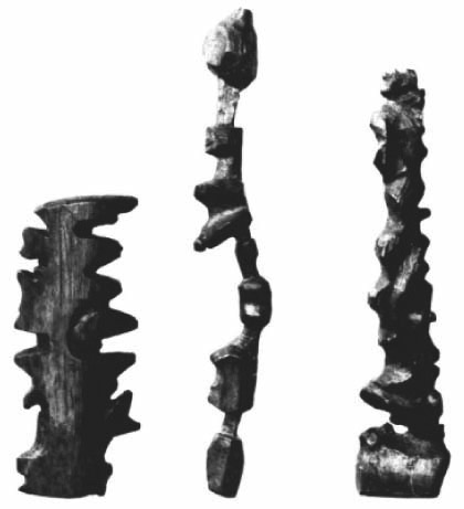
How would you define a map? A type in a popular search engine beginning with ‘G’, has a familiar definition, “a diagrammatic representation of an area of land or sea showing physical features, cities, roads, etc.”, and indeed the word map derives from the word ‘mappa’ meaning sheet/napkin. However, ironically though ‘map’ isn’t restricted to this two dimensional version we can fold up; as we all know, we live a digital age where you navigate the world around you with your laptop or smartphone too. But what happens if you live somewhere with little to no mobile internet signal and sub-zero temperatures most of theRead More →

4. Map of the Day: Selden Map of China

2017-02-09
By: TheMole19
On: February 9, 2017
In: Map of the Day, maps, Uncategorized
Tagged: cartography, china, geography, history, maps
With: 0 Comments

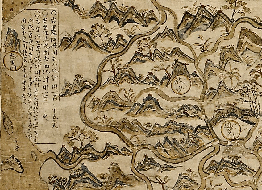
In a world where digital maps are available within a few clicks and can rely pre-loaded map projection systems to ensure we are mapping in the right location, for me it is always humbling and breathtaking the painstaking efforts and relative accuracy of older maps. One particular example is the Selden map of China (acquired from estate of London lawyer John Selden in 1659), one of the oldest surviving merchant trade maps, and one of the first Chinese maps to reach Europe, roughly dated 1607-1617. In many ways the beauty and craft of this map speaks for itself (see here), but there is more to thisRead More →

Some great old maps from Canada

2017-02-08
By: TheMole19
On: February 8, 2017
In: Map of the Day, maps, Uncategorized
Tagged: canada, geography, history, maps, Motd, old maps
With: 0 Comments

I recently came across a copy of an old school book, “Picture Map Geography of Canada and Alaska” by Vernon Quinn, that includes charming woodcut picture maps by Bruno da Osimo, a then noted Italian illustrator, for each of the Canadian provinces (other than Nunavut, which was then part of the Northwest Territories). Originally published in 1944 […] via Vintage Picture Map Geography of Canada — O’ CanadaRead More →

3. Map of the Day – Map powered cars (ZAP MAP)

2017-02-08
By: TheMole19
On: February 8, 2017
In: gis, Map of the Day, maps, Uncategorized
Tagged: cars, green, mapping, Motd, web development
With: 0 Comments

Whether you drive an electric car, a ‘normal’ car, or don’t drive at all, this web and mobile (Android and iOS) application from ZapMap is well worth taking a look at. Powered by Google Maps API, this mapping tool provides the locations of electric car chargers, providing pop up boxes with the latest status of these charging points, types and directions on how to get there. Although the shading of the vector tiles is a bit gaudy, with an ability to log in, map and comment on charging points, there is potential for up-to-date community empowered mapping to provide latest running statuses and charging locations.Read More →

Posts pagination

Previous 1 2 3 Next

Site Menu

  • The Map Den
  • maps
  • data visualisation
  • My Maps
  • Music Map
    • Music Map
    • Music Map: FAQs
    • Music Map: Archive
  • About

Recent Posts

  • Santa Claus Travel Time Maps
  • Twas Brexit What Won It – Re: UK General Election 2019
  • UK General Election 2019 – Maps and Cartograms
  • How I made a Music Map
  • Mapping Music – Search and Explore

Tags

africa arcgis brazil canada carto cartography christmas climate culture data data visualisation economics england environment europe football geography geospatial germany gis history map mapbox mapping maps Motd music netherlands old maps OriginalContent politics Population quiz russia santa claus satellite sport transport travel UK urban usa Wales web development world

Designed using Dispatch. Powered by WordPress.