
This part one of a series on capital cities, exploring influences on their location and history. There will be maps.
What about capital cities anyway?
Allow me to be controversial – geography is important. I’d actually go as far to say it’s vital. Don’t let comments about it just “being colouring in” tell you otherwise (though I do love colouring in). It’s the influencing factor that explains why where we live or work exist. Whether it’s proximity to water, transport links, natural resources, defensive position or simply other locations – these are all factors.
Historically or more recently, locations don’t just ‘happen’ – they emerge from existing physical and human geography. It’s the same with capital cities – they evolve and/or take advantage of their geography. A stereotypical view of a geography at school involves, among other thing, learning national capitals. This is much like other subjects, history learning dates of important events, the periodic table in chemistry, times tables in maths. But why?
There is, of course, far more to geography than capital cities. But this, and the urban and political geography of capitals and ‘primate’ cities is still important – often being the focal points of a nation’s culture, economy and politics in the modern world. When one thinks of a nation they are often tied to its capital city – think France and many will think of the Eiffel Tower in Paris. Furthermore, just watch the news and often international relations will be described between “London and Washington DC”, “Paris and Berlin”, “Beijing and Washington DC” etc.
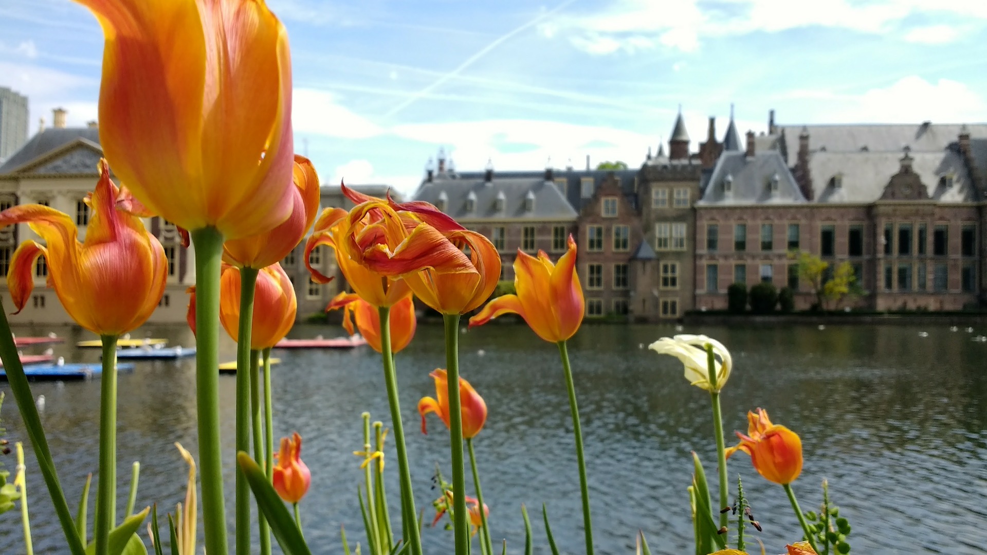
Defining a capital isn’t necessarily a simple one – it can be defined simply as the city which has primary status and (often) the seat of government of a nation (or state etc), usually designated so by constitution or law. However, there are many cases where the largest, and most ‘important’ city in a country isn’t the capital – e.g. New York is America’s largest city and where Wall Street resides, but Washington, D.C. is the capital. Similar situations exist in Canada, New Zealand, Australia and Brazil. Furthermore, the seat of government doesn’t always reside there – e.g. the Dutch ‘Binnenhof’ resides in Den Haag, not Amsterdam. Also, technically you don’t need just one capital – South Africa technically has three capitals, Cape Town (legislative capital), Pretoria (administrative), Bloemfontein (judicial).
‘Natural’ Capitals
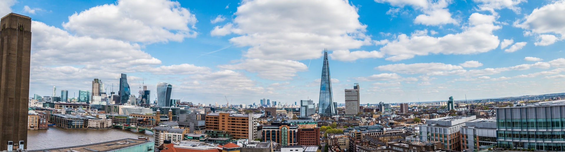
In medieval times, before the relatively modern concept of a ‘nation state’, an itinerant (wandering) government was common, the court following where an monarch was situated, rather than a static ‘capital’. The official designation of a capital city in Western Europe during this time, merely confirmed the natural order of national importance of a city. For example, London grew organically as a financial hub – thanks its favourable geography in a river valley in the South of England close to Northern Europe.
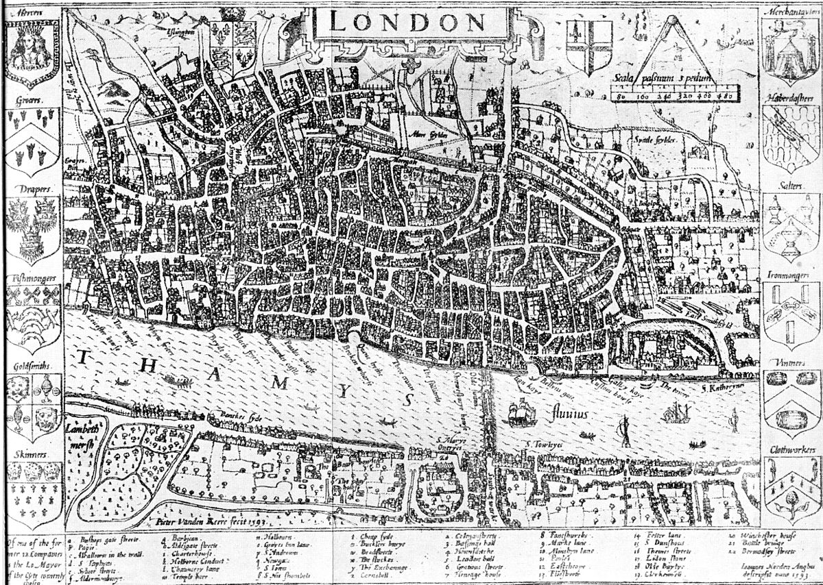
The king moving his residence to Westminster attracted by London’s prosperity (then just on the edge of London), only confirmed ‘permanent’ political power in London itself in the 14th Century. Similarly, cities like Paris or Vienna grew gradually based on defensive, economic and historical geography – only when centralised governments and nation states became a concept in Western Europe, did it confirm these primary cities as ‘capitals’.
However, from the 18th Century onward, we’ve seen capitals move, become designated and established on political compromise, strategic location, historical importance and other reasons – often during the process of creating new nation states. Here, unlike in situations in Asia and Europe, the formation and ideas of nations and borders have often been ‘artificially’ created rather than evolve over time, whether by their own leaders or, in often in the case of Africa, by foreign rulers.
Thus, capital cities, have also followed this – ‘selecting’ a capital, rather than emerging naturally. This decision making process of location, especially the planned national capital is fascinating to a geographer from ‘old’ Europe, so let’s look at this further.
Breaking new ground
The central African country of Equatorial Guinea will be the latest country to change capital, when it makes its move from the island city Malabo to a planned city on the mainland under construction called Ciudad de la Paz. The planned city’s location was chosen for its easy access and benign climate. Government offices have already begun moving to the new city, with an estimated completion of 2020. The Portuguese urban planners involved hope for this to be the first “global capital city completely dependent on renewable and sustainable energy”.
Planned capital cities are nothing new however, and not necessarily a recent phenomena – the factors and motivators behind them vary. An early example is from 1571 in Malta with Valletta. Famous examples include Brasília and Washington D.C. Brazil’s capital, designed by Lucio Costa under the Kubitschek regime (announced in 1956), was part of political ideology of modernisation to drive economic growth in the centre and interior of Brazil, and away from the coastal megacities of Rio de Janeiro (capital until 1960) and São Paulo. An article of the country’s first republican constitution dating back to 1891 stated the capital should be moved from Rio de Janeiro to a place close to the country’s centre.
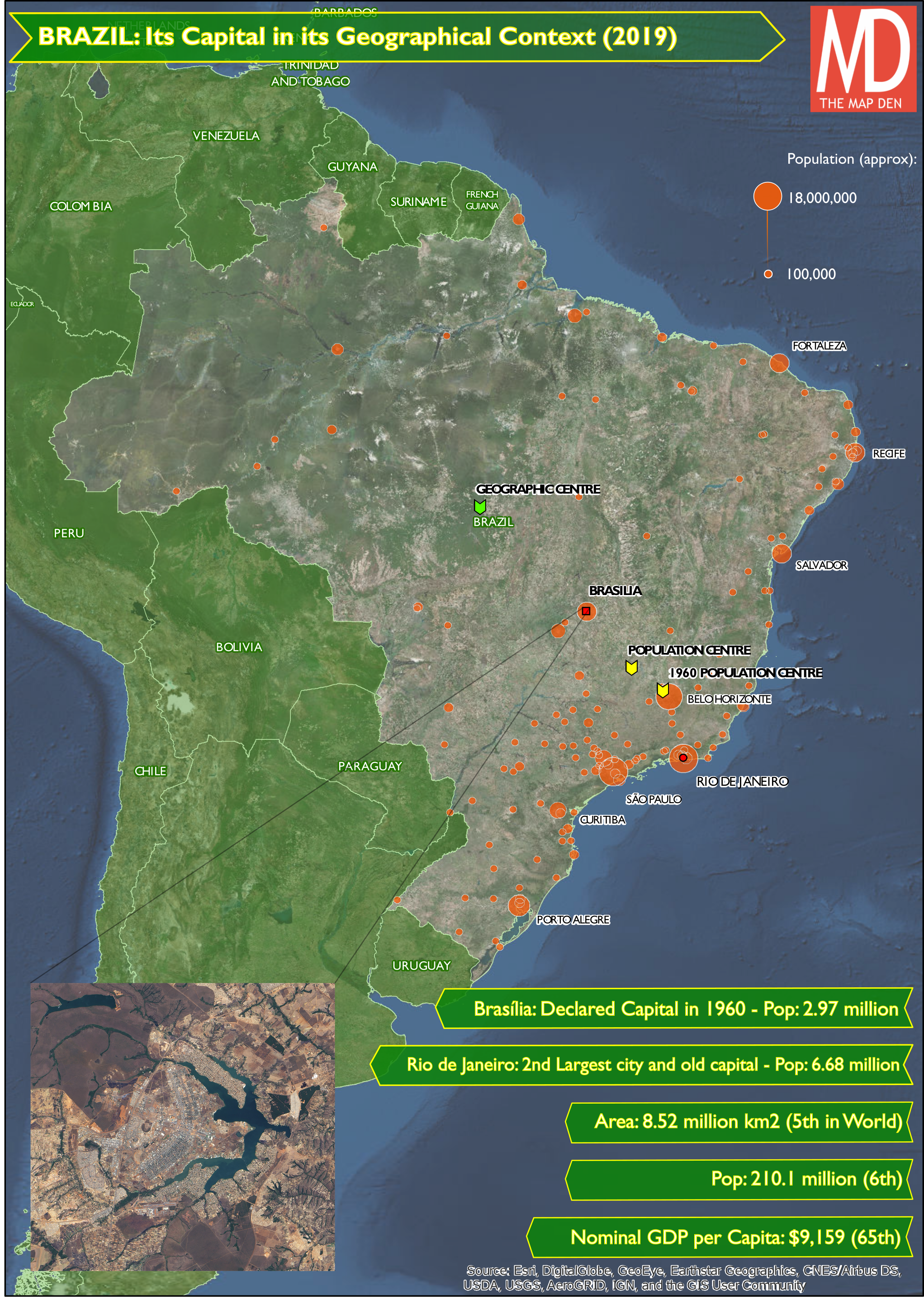
The final city has, a bird-like shape, with ‘sectors’ and famous modernist architecture and monuments designed by Oscar Niemeyer. The jury is out whether this move has been a success. It is now Brazil’s third largest city, and there are obvious advantages to having a city which serves a dedicated political function. However, the economic and cultural heart remains in the coastal megacities and even less considerable (near) coastal cities such as Salvador or Belo Horizonte. The history and economic advantages of coastal urban geography of Brazil is strong when compared to the less developed, less navigable, and tropical interior. Artificially attempting to manipulate and reverse this geographical logic is difficult.
Capitals of Compromise
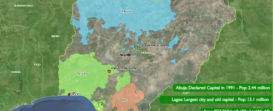
A particularly recent example, is Nigeria’s strategically placed capital city Abuja in the centre of the country. Nigeria is a country of potential economic riches, given its large population and oil wealth. However post-independence, the country has seen struggles, like many post-colonial African nations, due to corrupt politics, ethnic divides and resulting civil wars. Nigeria is a country with three largest ethnic groups – Hausa-Fulani to the north (predominantly Muslim), Yoruba to the south west and Igbo to the south east (predominantly Christian). After being announced by the military government in 1976, the capital was moved from a congested and crowded Lagos in 1991, to this planned city, which was independent of these three major ethnic groups.
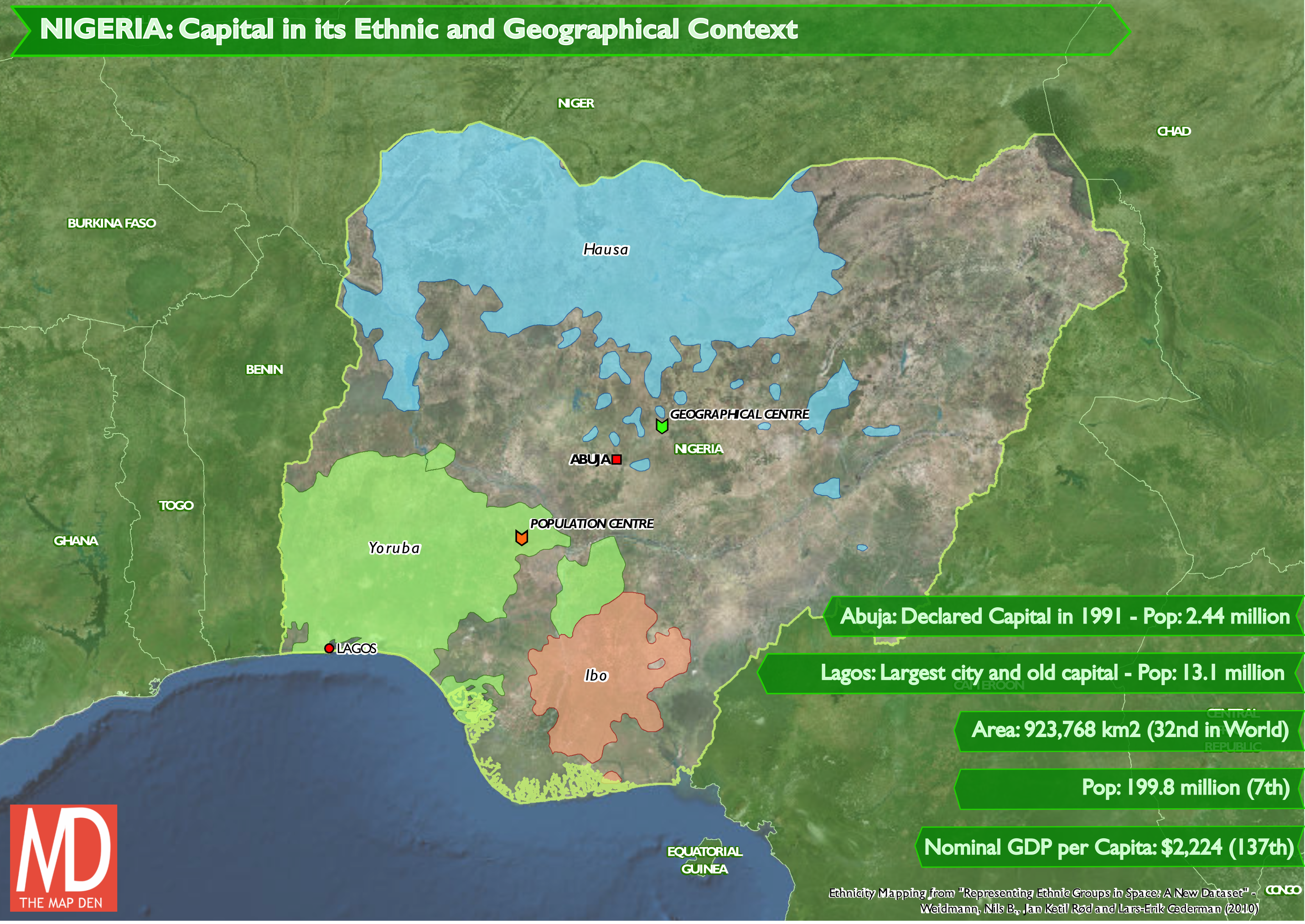
Abuja isn’t the first capital based on political and strategic compromise. Australia’s capital Canberra, completed in 1927, was designed by the American architects Walter Burley Griffin and Marion Mahony Griffin. The inland site between Sydney and Melbourne, Australia’s two biggest and competing cities for this position, was selected as a compromise between the two, as well as being being less vulnerable to sea attacks. Earlier in 1857, in the then British Dominion of Canada, the then frontier town of Ottawa was selected to be the capital of Canada – a choice that has stuck post-independence.
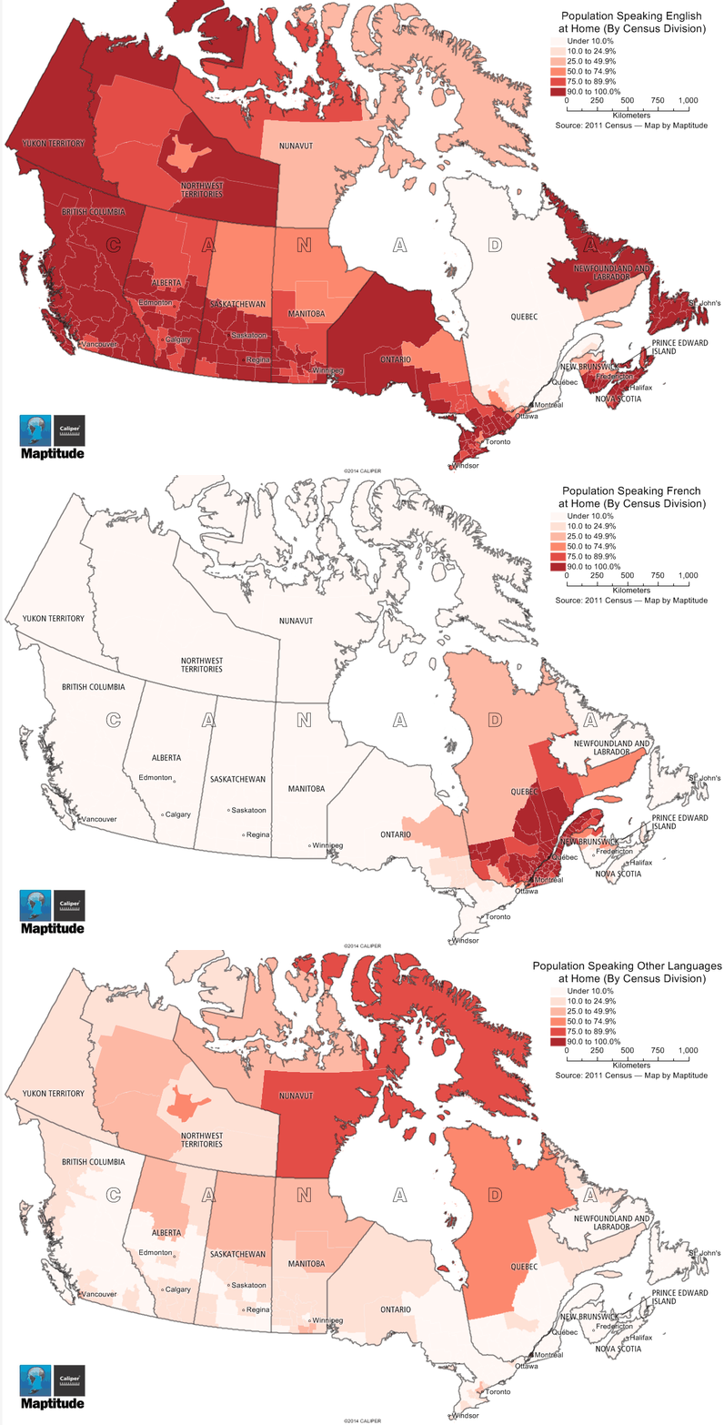
This was strategically chosen on two geographical factors. Its location in dense forest far from the US-Canada border on a cliff face, made it a strong defensive position, as well as having seasonal access to Montreal via the Ottawa river allowing for transportation. Perhaps as, if not more significant, its situation approximately between Kingston and Toronto in the English speaking Canada West, and the French speaking Montreal and Quebec to the West – made it a good compromise. While English tends to be more dominant in modern Canada, the French-English divide still follows this geography and this compromise.
Next time, we will explore Washington D.C. and other capital cities to examine the political influences on capital cities.
This part one of a series on capital cities, exploring influences on their location and history. Stay tuned for part two.
Happy Mapping,
David
3 Comments